
see what legislative districts cover orange county
Below are the Orange County towns and cities contained in each district.
Orange County Legislature
In 2024, the Orange County Legislature approved new district boundaries based on the 2020 census. Ahead of the 2025 elections for Orange County Legislature, please use the following links for more information.
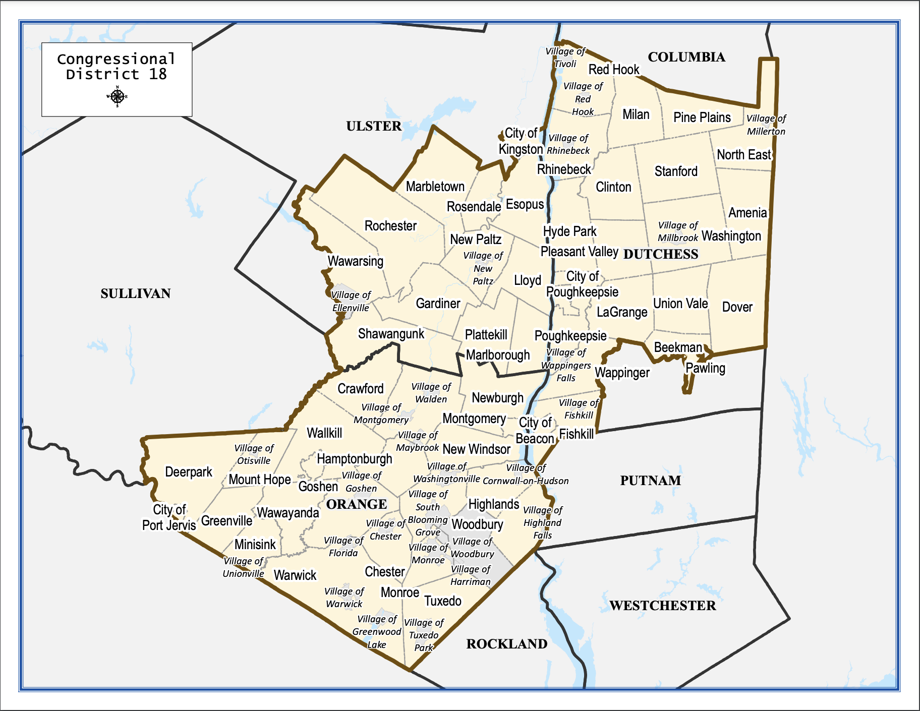
18th Congressional District
All of Orange County is contained within the 18th District.

42nd nys senate district
City of Middletown, City of Port Jervis, Deerpark, Greenville, Mount Hope, Minisink, Wawayanda, Wallkill, Warwick, Goshen, Hamptonburgh, Crawford, New Windsor, Blooming Grove, Cornwall, Highlands, Woodbury, Monroe, Palm Tree, Chester, and Tuxedo.
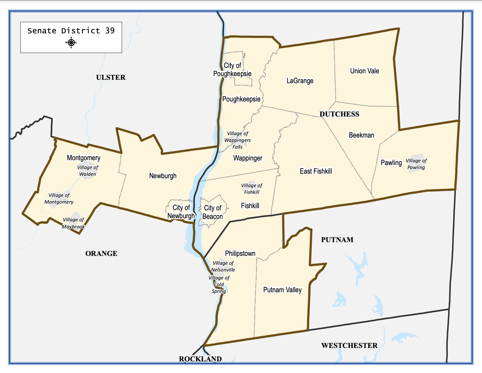
39th NYS Senate District
City of Newburgh, Town of Newburgh, Town of Montgomery
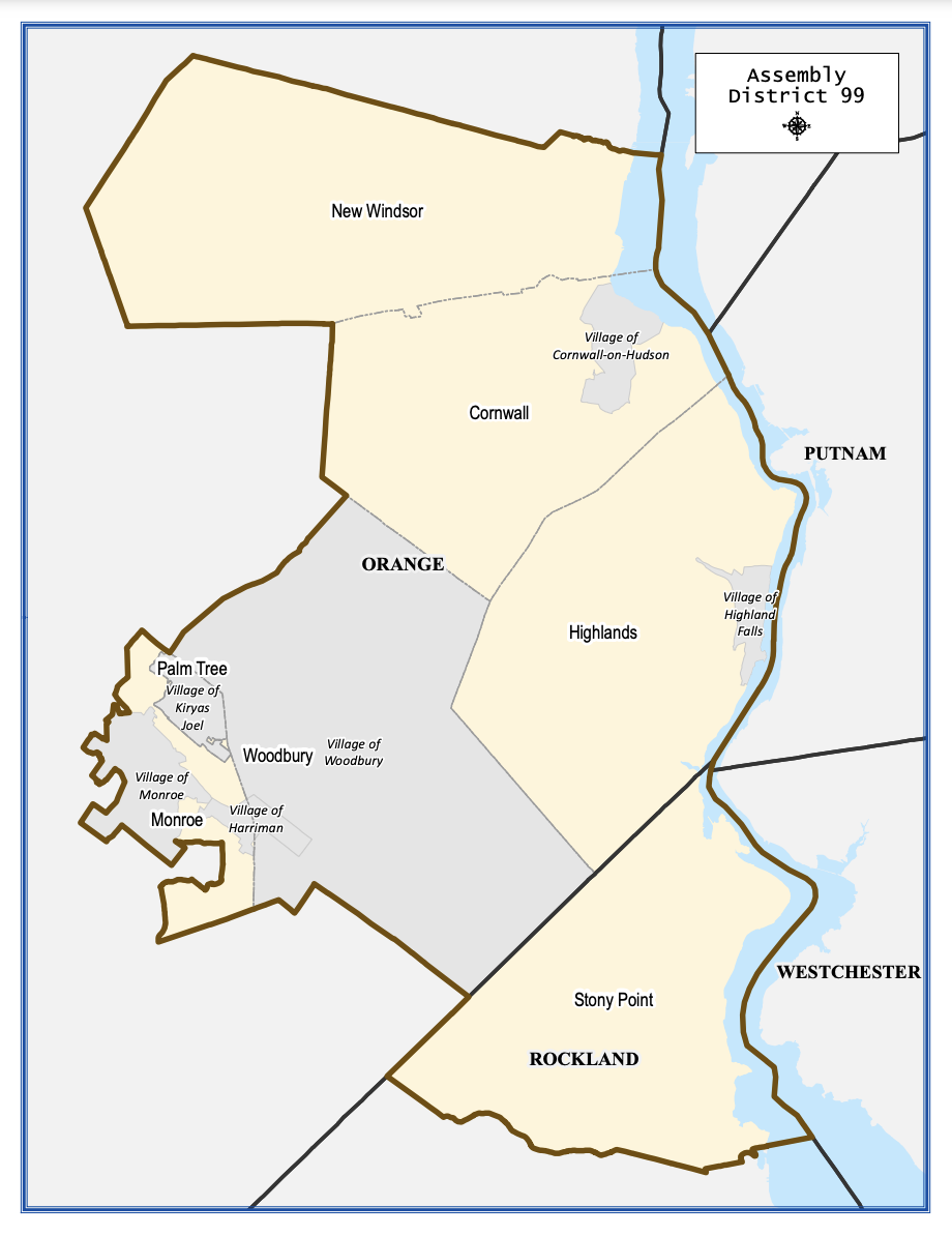
Assembly District 99
New Windsor, Cornwall, Highlands, Woodbury, Palm Tree, and parts of Monroe.
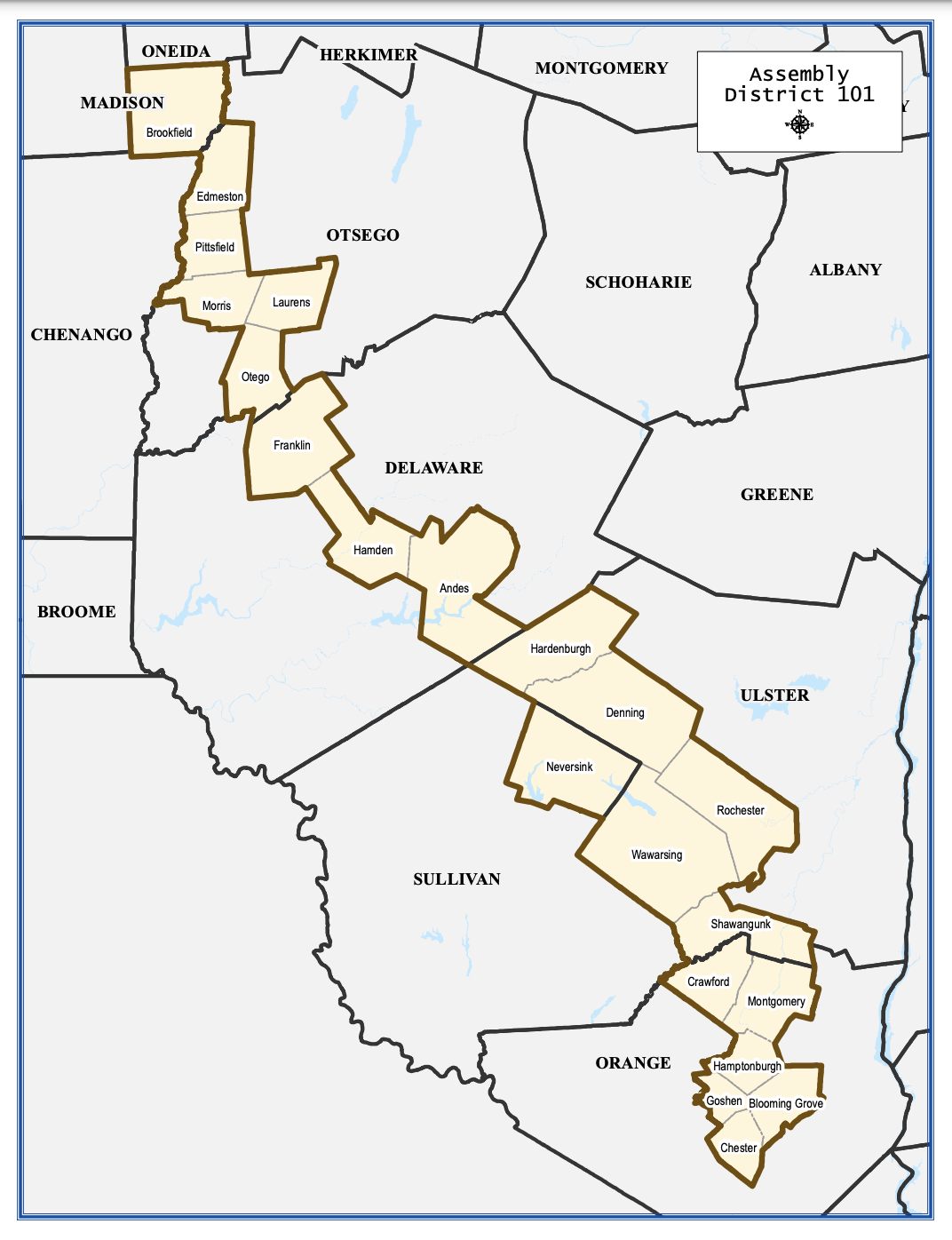
Assembly District 101
Chester, Blooming Grove, Hamptonburgh, Crawford, Montgomery, Parts of Goshen.
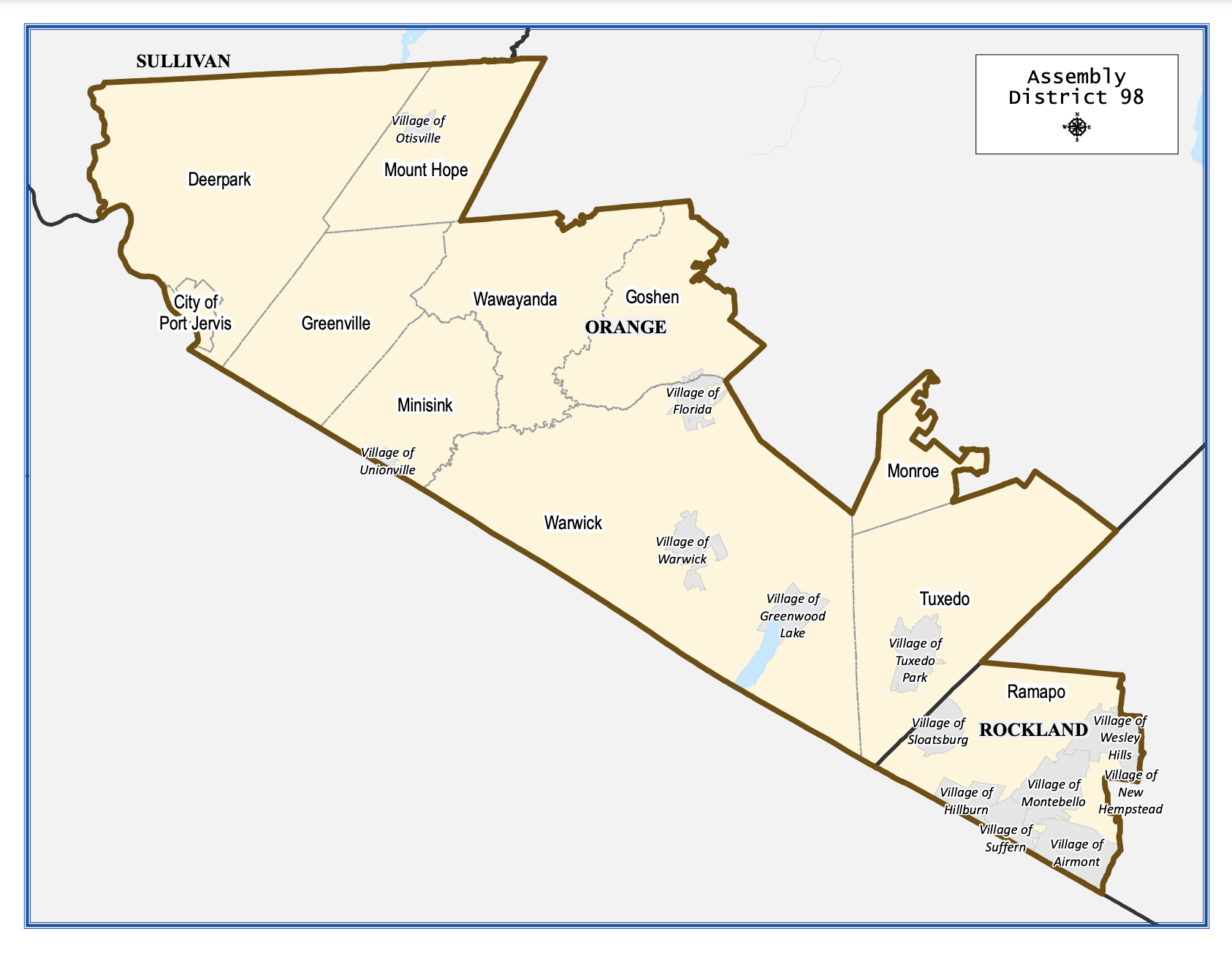
Port Jervis, Deerpark, Greenville, Mount Hope, Minisink, Wawayanda, Warwick, Tuxedo, parts of Goshen and Monroe.
Assembly District 98
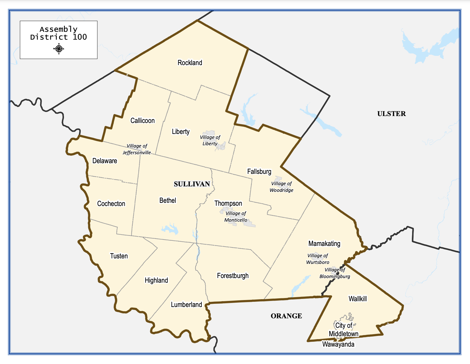
Assembly District 100
Wallkill, City of Middletown.

Assembly District 104
City of Newburgh, Town of Newburgh